 OK, so before I get to today's hike, I have quite a bit of updating to do. I'm going to skip the stats for previous days. If, when I'm looking back at this entry years from now I really want to know what I did with numerical clarity, I've got plenty of places to go.
So, what have I done since we last 'spoke'? Well, Tuesday I biked a wonderful 20+ miles, then hiked up at Galena creek with the Sierra club. A full day. Then, I started on that paper I told you about.
Wednesday I did... nothing. Except type.
Thursday I did... nothing. Except let my brain recover from typing.
One day I'll stop procrastinating on papers/reports. Really. The problem is just that I keep getting away with it! Well, except for some stress and bags under my eyes. (Oh, and if my professor for this course happens to be reading this in some bizarre coincidence, I'm talking about another paper for another course. Really. You see nothing here.) (Do Jedi mind tricks work over blogs?)
OK, so, on Friday... my Garmin's batteries were dead! Oh, heavens! I made it to the other side of the smoke from a nearby fire, all ready to run and cycle, and my Garmin is dead? What to do? Seriously, I'm a data addict. It actually ran through my head to pack it all up and go home, just because I wouldn't have the semi-exact data that my GPS gives. I have issues.
So, what did I do? Luckily, I had run that river path before. I did exactly the route I was unable to successfully complete last Friday... slightly more successfully, but not perfectly. Simple enough. Hey - my watch has a timer, right? Su'nough. I did it old school, even though I've never run without my GPS. Seriously, I think I had my Garmin before I ever ran last year! No wonder I almost teared up when my 301 broke! (Speaking of tearing up, I'm missing my 30gb iPod video. I lost/misplaced/had it taken yesterday afternoon. Talk about withdrawl!)
Moving on. After my run, I biked, timed my ride, and figured out how far I went using the wonders of mapping software on the internet. Though it has its annoying quirks, and is missing some really basic features, I really like toporoute.com , just because it'll follow roads for you so you don't have to click the map 30 times to trace a half mile on a winding road.
OK, so I cheated and got all the data I wanted without my Garmin, but c'mon - I'm making baby steps here.
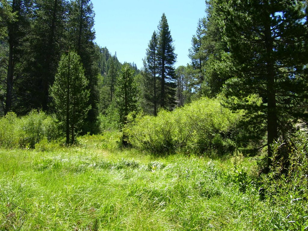 So today? I made sure the Garmin was completely charged for today's hike to Marlette Lake. :) I don't know why, it always has a different length for hikes than the rangers and map guides have. So, I'll go with the official book's info: 10 mile round-trip, 900 feet elevation gain, total hiking: 4 hours, 15 minutes.
Yes, you read that correctly. I hiked ten miles today. Another personal milestone... so to speak. I'll tell you, I had a hard time on the way up. More than once I thought about the fact that I'd still have to make it back to the car and wondered if I might be better off turning around at the 2.5 mile mark... 3 mile mark... (OK, I can do one more mile) 4 mile mark... (Well, only one mile left). And hey - there's the lake!
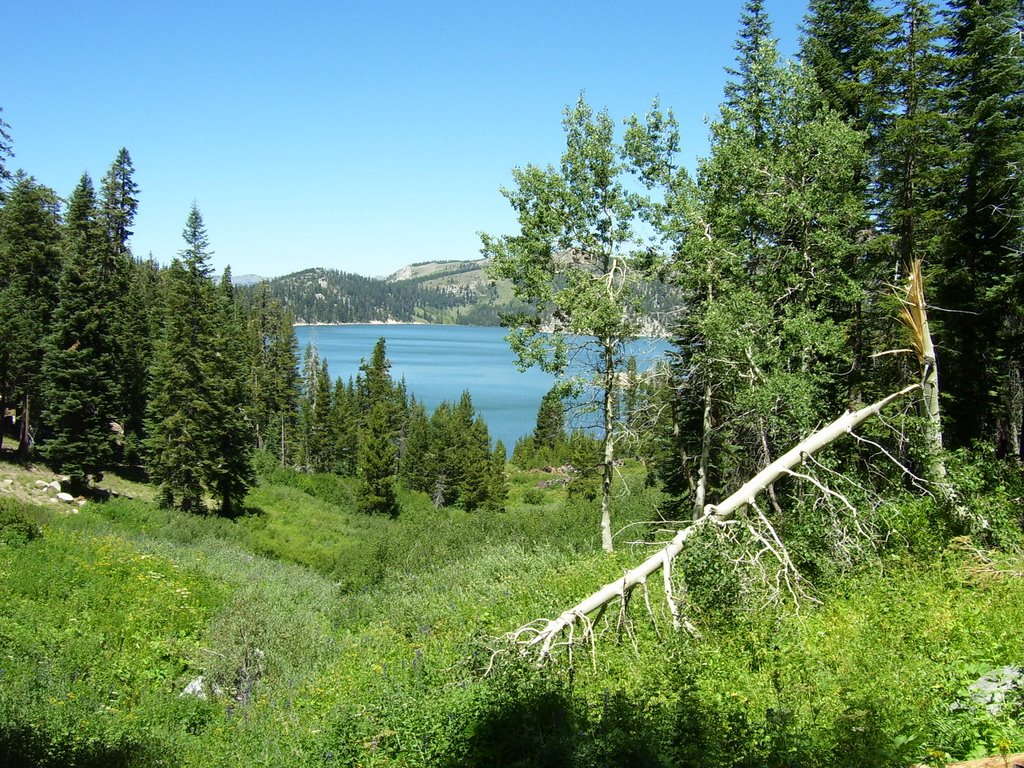 Actually, I caught a glimpse of it before this shot. It's really a little special when you first view a destination lake. It's a little bit of a tada! moment, with the curtains being slowly unveiled. You can even pass other lakes, and it's nice, but nothing special. But the moment the clearing opens up to your destination, well... that's something!
My feet ache, of course, and I'm not looking forward to those first few steps tomorrow morning. (Plantar Fasciitis is almost always worst in the morning, after the calves and tendons tighten up overnight.) But, I think even my feet are getting conditioned to handling longer and harder hikes. Yay!
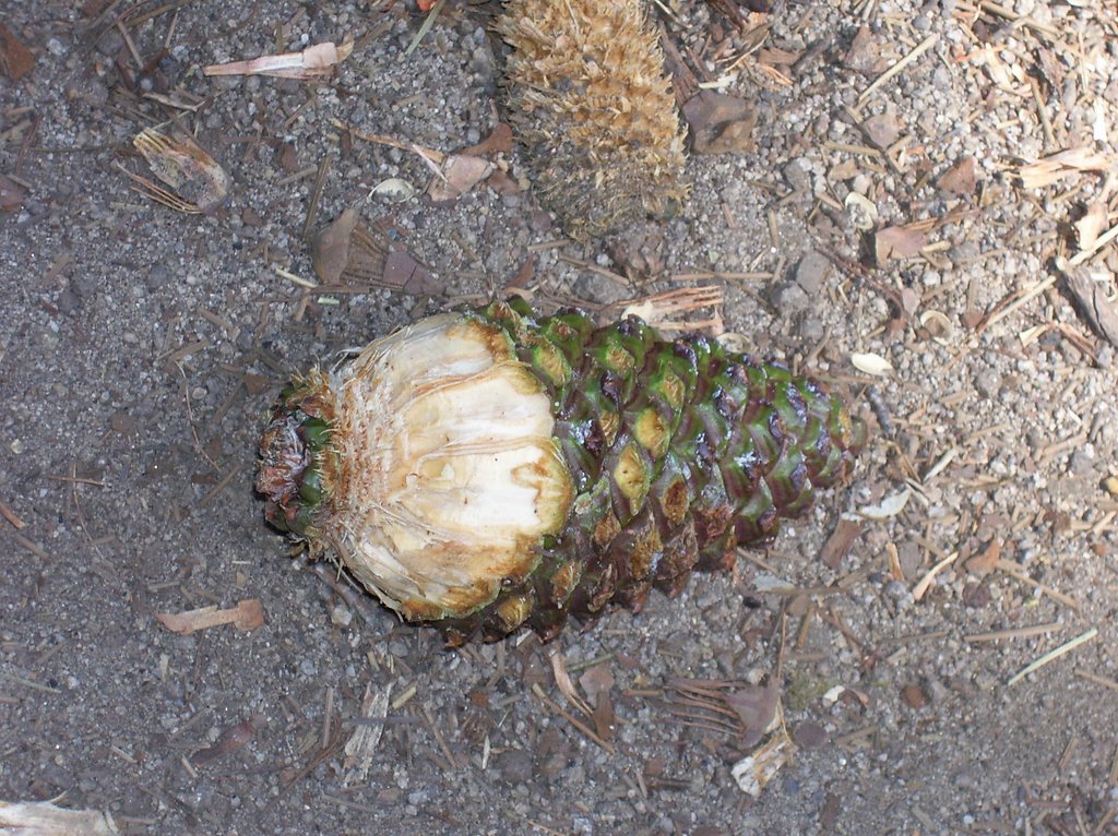
OK, I think I've tortured you with enough babble. You are still reading, right? OK, as your reward, here are two more pictures. One's another view of Marlette Lake, and the other has a [short] story benind it. I saw a squirrel climbing a tree, but then he (she?) ran to the other side when he saw me. I tried to sneak up on it, hoping I could catch a picture from the other side. Just when I gave up and went back to plodding along, I saw him. Unfortunately, he saw me, too! He panicked, fled, and dropped his - lunch? I felt horrible. The least I could do is take a picture of his lost booty. I've never seen a pine cone stripped like this. It's a bit interesting, I think. Your mileage may vary.


2 comments:
What annoying quirks?
Send me an email using the feedback link on Toporoute, and I'll see about fixing those quirks.
Martin
I'll e-mail, but I'll also post:
I have to say that the main "annoying quirk" is that the user has to learn a strategy to make sure that Toporoute doesn't backtrack and take another road. I don't think that it's fixable. The user just has to fix his/her thought process when clicking. If you happen to click in a way that causes Toporoute to backtrack and take an unexpected road, you have to hit undo many, many times to correct it.
The other "quirk" (that's also probably a little unfair) most likely only affects a few users. I use a tabbed browser, and I occasionally close the wrong window. If I hit "undo", to reopen Toporoute, I go back to the main entry page rather than the map I was in. I understand that there's no way to hope that my route thus far would still be there, but I have to start completely over and zoom back in on my town. Again, I don't think that it's fixable.
But, this could be improved by the addition of one of the lacking features. It would be great if users could enter a starting zip code rather than having to spend time zooming and moving the map around to just get to the starting area.
Just my thoughts. But, again, I tend to find myself returning to toporoute.com more than any other site in the increasing myriad of websites in this genre. So, I guess that speaks to how much I value the benefits over the "quirks".
Post a Comment